
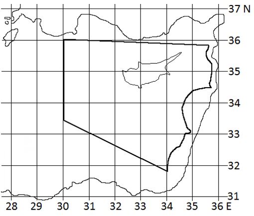
NICOSIA FIR FORECAST
|
|
CYPRUS DEPARTMENT OF METEOROLOGY |
|
|
NICOSIA FIR FORECAST
|
| Valid from: | 0600 UTC 03/08/2026 | Issued at: | 0400 UTC 03/08/2026 |
| Valid to: | 1800 UTC 03/08/2026 | Issued by: | MP |
|
This is an area forecast and the information is not
intended to apply to any particular station or route.
All heights are in feet AMSL.
Special features of the meteorological situation:
WEAK SOUTHWESTERLY FLOW OVER THE F.I.R.
|
|
| Upper winds (deg. true and knots) and temperatures (°C) at: | |
| FL050 | 28005 PS22 |
| FL100 | 23010 PS13 |
| FL180 | 21020 MS02 |
| FL240 | 22025 MS13 |
| FL300 | 25025 MS24 |
| FL340 | 24025 MS34 |
| FL390 | 24030 MS46 |
| Cloud: | NO SIGNIFICANT CLOUD |
| Height of 0 °C isotherm: | 17000/18000 LATER 17500/18500 |
| Airframe icing: | NIL |
| Turbulence: | NIL |
| Significant weather: | NIL |
| SIGMETs for the Nicosia FIR in force at the time of the issue of the forecast: |
| NIL |